Written by Adele Machin
Monday 30 June 2014
Alice Springs – Chambers Pillar – 164kms
We are currently at Alice Springs, 2500kms from home.
We awoke to 1.5 degrees and a very cold wind. Thank goodness for our ensuite as we could go in there for relief from the wind. A bit squeezy though.
We all met outside the camping ground in a convoy of 13 cars. Two cars had decided to leave earlier and meet us there.
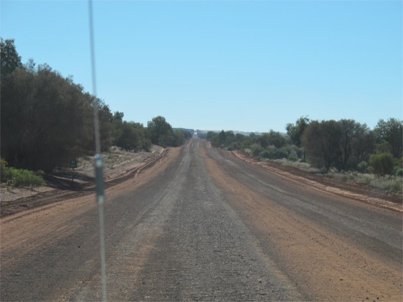
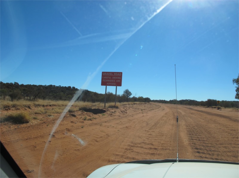
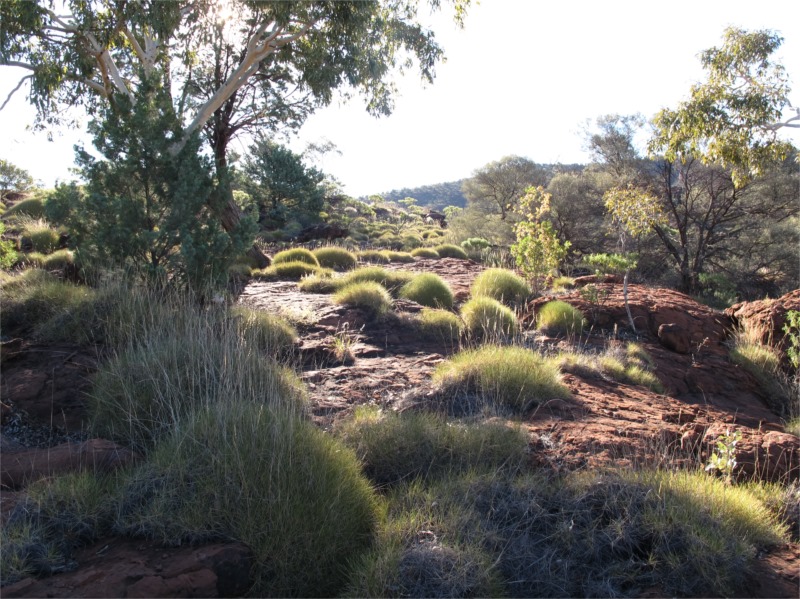
After about 10klms of seal we turned off for Chambers Pillar and hit dirt roads and rough dirt roads immediately.
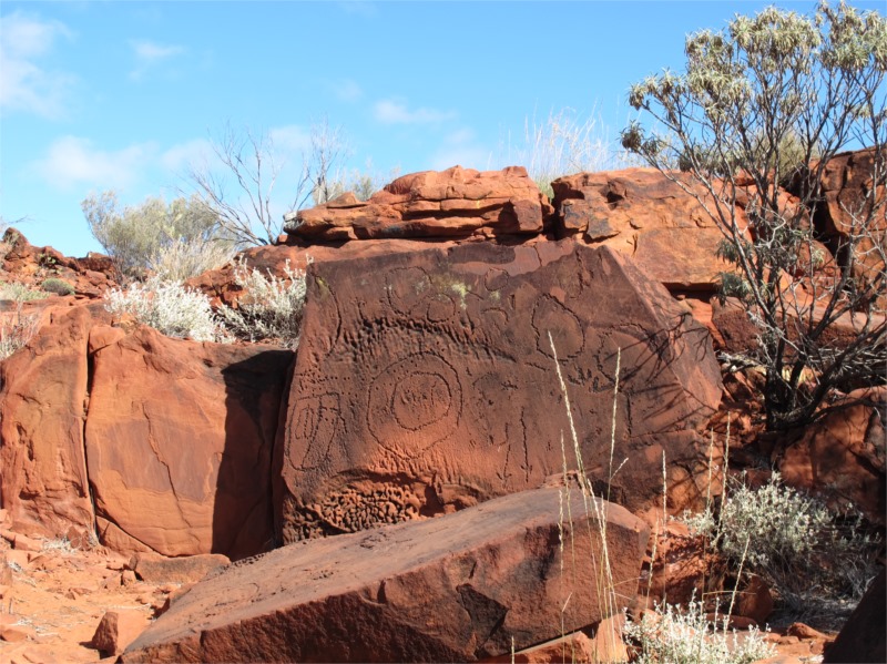
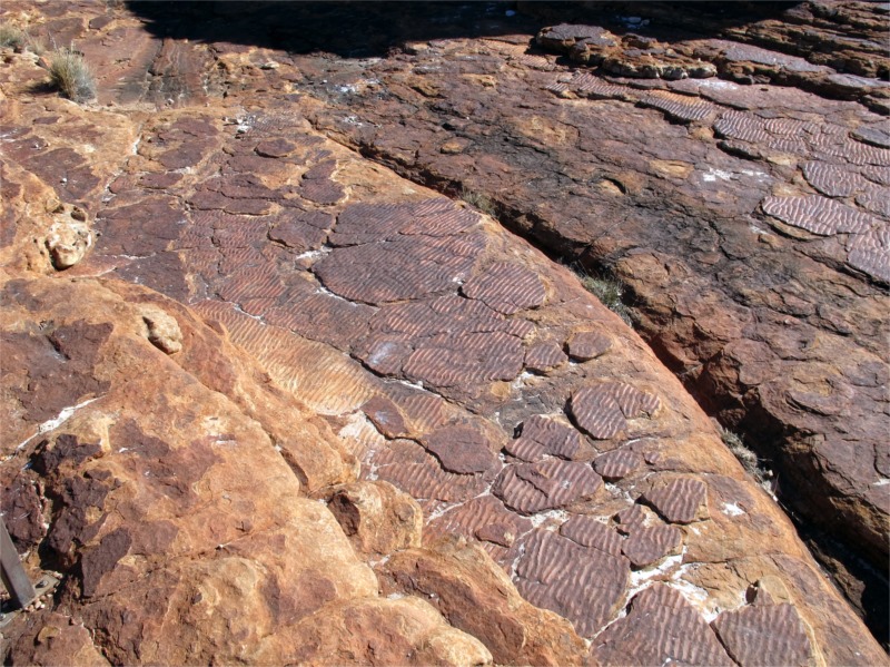
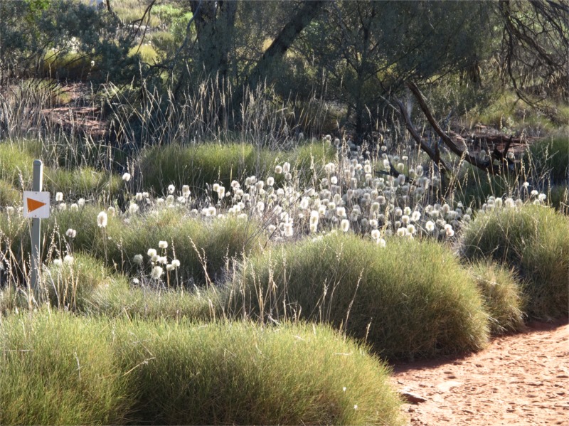
After travelling for about 39klms we came to the Ewaninga Rock Carvings where all the would be photographers emerged to take some photos. It was a nice walk on the clay pan and view the carvings on the sandstone which featured a variety of symbols and motifs written by the Arrernte people. There were also interesting shrubs and flowers.
From there were passed the Rodinga Ruins which was an old railway siding from the Ghan era.
Onto Maryvale where there is a shop, at last my ice cream and a toilet. We stopped there for lunch before continuing to Chambers Pillar.
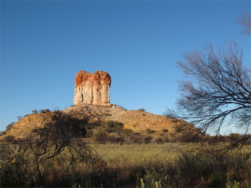
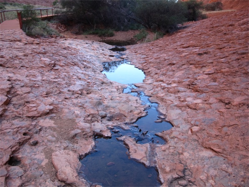
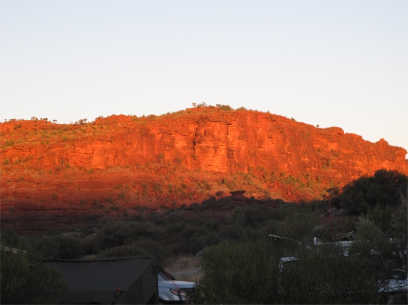
At Chambers Pillar there are two camping grounds and toilets (though I took one look at the toilet and said, no thank you.) One camping ground was pretty full and we moved to the other one which was closer to the pillar and filled it with all our guys. After everyone set up we walked to the Pillar which was only 10min away to either setup cameras ready for sunset or to climb the pillar (on the designated stairs and platform) for a wonderful view of the valley. We chose to do both but didn’t wait for full sunset as it was getting too cold.
We lit a big fire for everyone to sit around. Some cooked on it and others just enjoyed the Bush TV and conversation. The girls cooked bananas with chocolate inside which was a big hit with most of us sweet tooths. It got too cold so we retired to our electric blanket.
Tuesday 1 July 2014
Northern Territory Anniversary Day
Chambers Pillar – Kulgera – 323kms
We woke to 1.5 degrees again but thankfully no wind. We all drove in convoy today except one couple who have a Jayco. The leader didn’t think it would travel well on the rough roads we expected, so they travelled with us back to Maryvale and took a stock route back to Stuart Highway where they would stay at another caravan park overnight and we’d catch up with them on the way to Yulara tomorrow.
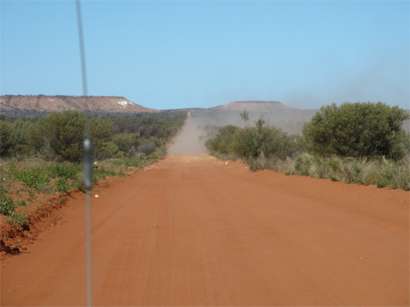
Chambers Pillar is one way in so we travelled back to Maryvale and turned south to Kulgera. It wasn’t long before our leader, John, got a flat tyre in his Landcruiser. A brand new tyre destroyed. It was hard to change as the jack just kept sinking into the bull dust. Eventually the problem was solved and we were on our way again. This road used to be the Ghan railway line and when the tracks were removed the spikes on the sleepers were left on the road. This is what spiked the tyre. We travelled along the Ghan highway to Finke and along the way viewed many ruins of sidings form the Ghan era. We stopped at one for lunch and John took photos from a nearby sand dune.
The Finke highway was in pretty good condition as the Finke desert race had only been on recently and we could see all the tracks where it had been. (That race is now on my bucket list to go out and see it, the track looks amazing.)
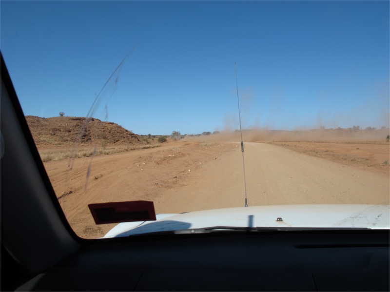
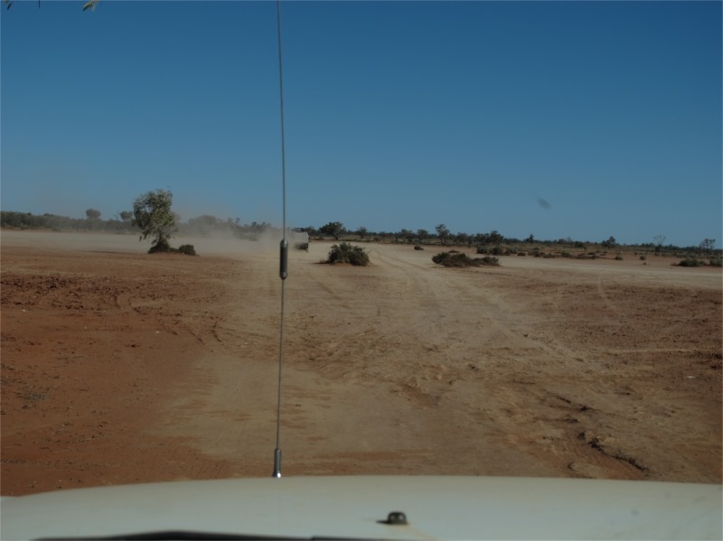
When they graded the Finke Highway they didn’t take all the spikes away so there were hundreds in the bull dust per kilometre which we needed to avoid. We all travelled a kilometre at least apart to keep out of the dust and warned each other on the 2-way of any spikes, holes etc. Even though the road was good it took a long time to drive and was quite nerve wracking. Surprisingly no one else got a puncture which was great.
As we came into Finke we hit a huge Bull dust hole and had to wait until the car in front of us came out the other side before travelling through. It was amazing.
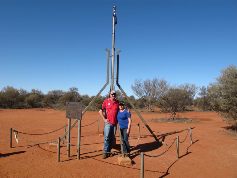
A few of us stopped to top up fuel in Finke while others kept going on to Lamberts Geographical Centre of Australia where we would all meet eventually. Finke is awful. Dusty, dirty and scary. Couldn’t wait to get out of there.
Lamberts is about 14kms from the main road on a very sandy reasonably rough track. On the way back one of the cars towing a camper broke a spring on their trailer and 3 cars stayed behind to help and became bush mechanics to fix it so they could get to Kulgera that night. They managed to do a fix, wonderful things wire and cable ties, and arrived at Kulgera roadhouse about 2 hours after all of us.
Kulgera was extremely cold and open. We camped behind the Roadhouse and were all looking forward to a hot shower. Unfortunately someone had tripped the switch and there was no hot water so a pommie wash was the go. We heard there was a fireplace inside the roadhouse so went to investigate, stayed and had dinner there. A much better option. The owners put on a fireworks display to celebrate NT Anniversary, and I will say this will be the only time in my life that I will witness fireworks at a petrol station. This could only happen in the Northern Territory but it was great to see Workplace Health and Safety hasn’t reached there yet.
Wednesday 2 July 2014
Kulgera – Yulara – 318kms
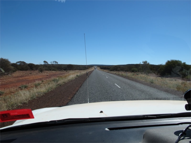
Woke to 5 degrees and a cold wind. After packing up at our leisure we all travelled separately so as not to clog the Stuart highway. Today will be all seal travelling and we have plenty of time to do the trip.
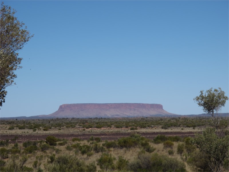
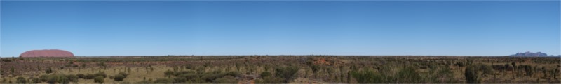
We stopped at the Desert Oasis for coffee (this is where the Jayco couple stayed overnight) and then travelled out to Yulara stopping at various photo stops. One stop was to view Mt Conner which is a flat mountain near the road to Uluru and it confuses visitors as it looks similar to Uluru.
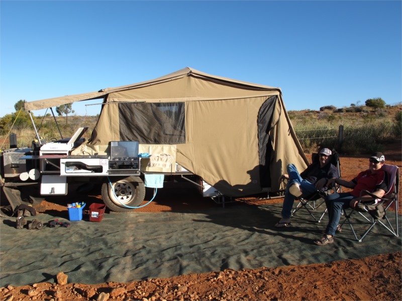
When we arrived at Yulara (Ayers Rock Resort Campground) we found that they hadn’t put us all together so we were rather scattered around the campground. It was full house because of the school holidays but we had a nice spot and ended up with Brian and Val, Stuart and Jean and Brickiematt from Victoria near us. Everyone else was way over the back. We were to stay here for 3 nights so we put the full annexe up so we could put the heater on if needed. This was needed each night and word got around so we had a full annexe of people after dinner each night trying to keep warm. Everyone was very envious of our heater but we’d been out this way before and knew how cold it can get.
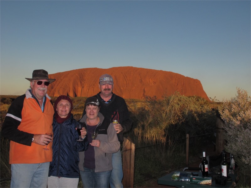
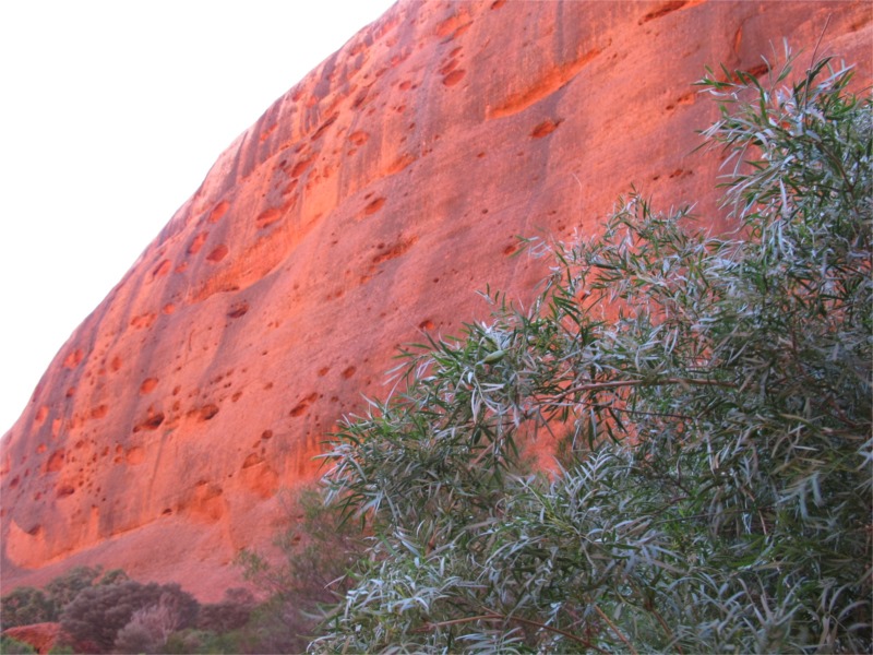
As soon as we arrived I got the washing done and there was enough sun and wind to dry everything that afternoon. About an hour before the sunset 6 of us drove to the sightseeing lookout where you can take photos of Uluru at sunset. We took a table, wine, nibbles and set up the tripod/camera and took loads of photos over the hour to see all the changing colours of the rock. She is just so majestic and sits there overseeing all the plants and animals around her. Just beautiful.
Then home to cook dinner, invited over some guests to share the heater and retired to our electric blanket.
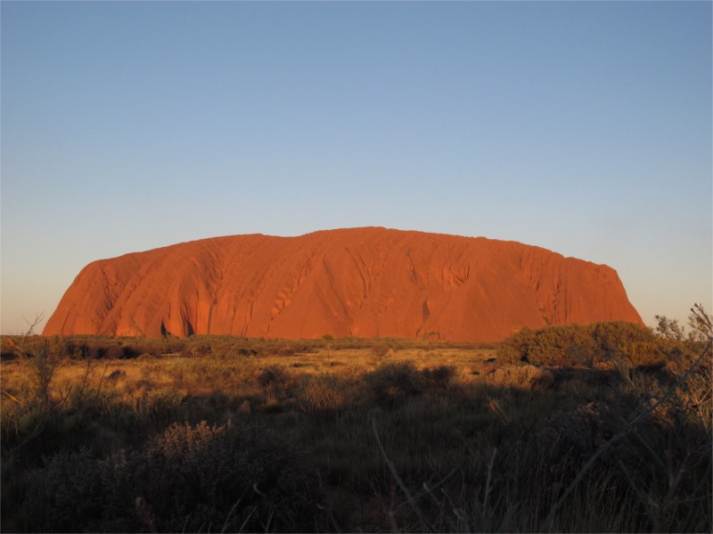
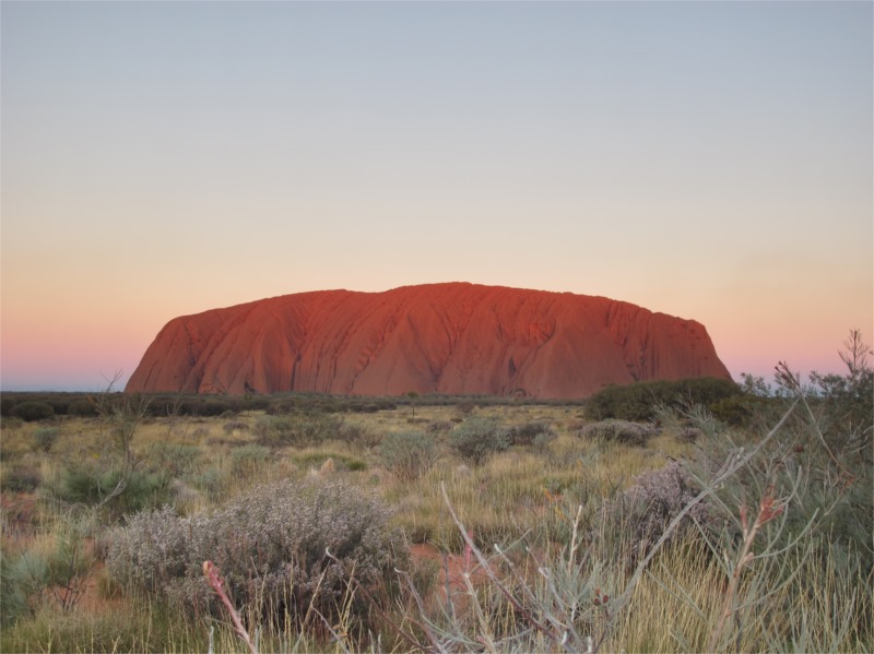
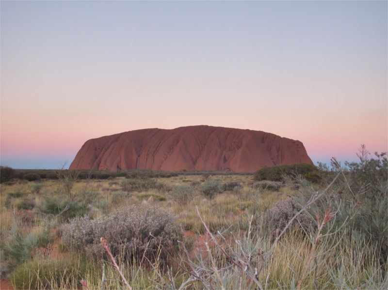
Sunset at The Rock
Thursday 3 July 2014
Woke to 3 degrees and reached 18 degrees today which was better for us Queenslanders.
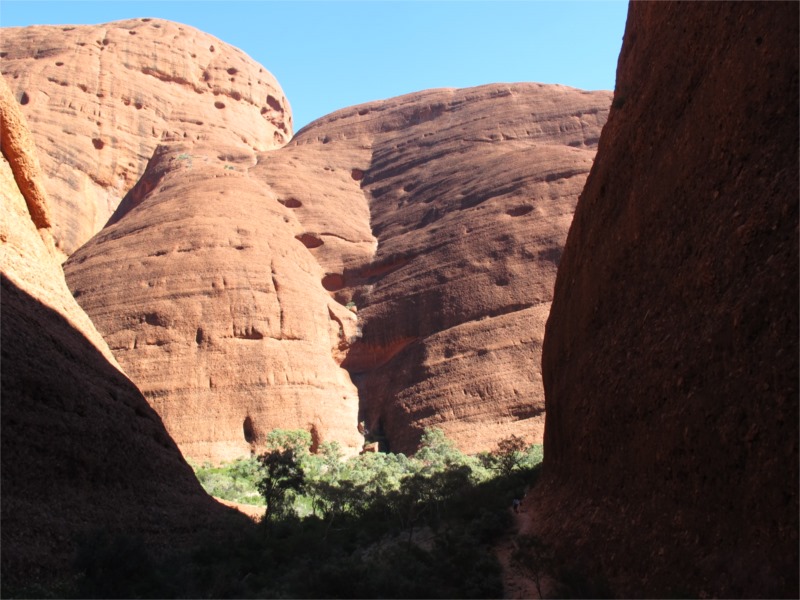
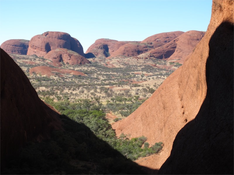
Some took off to climb Uluru and do guided walks around the base. We went to the Olgas as we’d been to Uluru before and not the Olgas. We tried to go for a walk at the Valley of the winds but the carpark was full so we drove to the Walpa Gorge and did a walk there. It was beautiful and we had picked the right time of day as the sun showed the real red colours of the rocks and the shadows in the pools etc were very photogenic. John got heaps of beautfiul photos.
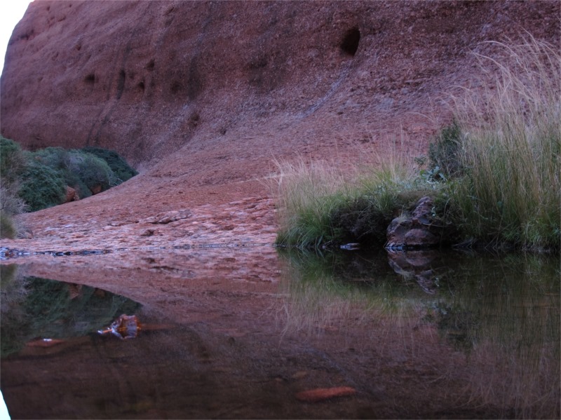
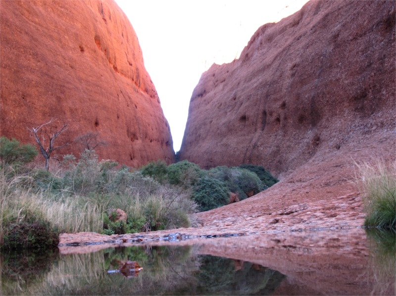
The Walpa Gorge walk
We then drove to Uluru to have a look and see if we could see anyone we knew climbing and I collected a jar of red sand to bring home.
When we arrived back at camp Val suggested her and I go and watch the Aboriginal dancing in the village so we caught the bus and went to see it. The dancing was really interesting the guys put on a great show. We decided to go walk-about and walked home via a lookout and didn’t get lost. By this time it was getting dark and time to cook dinner. Everyone then came to our tent for a few drinks and laughs.
Friday 4 July 2014
Woke to 1 degree. Now that is B…… cold. The day reached 22 degrees today which helped thaw us out.
After warming up we went to walk in the Valley of the Winds. I walked about 1 km but I wasn’t really well today so returned to the car and the others carried on. When they all returned we had lunch, then went back to camp and did some shopping in readiness for the trip tomorrow. We lazed around for a change and in the evening after dinner met up with everyone at the leaders caravan for a few drinks and instructions on what the procedures were for the next day. We then returned to camp and went to our warm bed and turned in early.
Saturday 5 – Sunday 6 July 2014
Yulara – Kings Creek Station – 269kms
Woke up to 4 degrees, packed up and left around 9.30am. We all met out on the highway and travelled in a split convoy to travel to our next destination. On the way we all stopped at Curtin Springs to top up our alcohol supplies. Much to our horror the prices were rather high. An ice cream cost $20 and a slab of beer cost $88 for XXXX Gold. Needless to say suddenly everyone found they had enough drink to get them through to the next stop. Brian bought a port called “Fucking Good Port” (once again only this could happen in the NT) which we had as a night cap. I thought he was joking when he told me the name of the port, but as you can see it was true. Didn’t taste too bad. (Better than Dr Jerds Jungle Juice you get down at Cessnock. )

That bottle
Kings Creek Station is about 30kms from Kings Canyon and is a good bush camp with plenty of activities for everyone. Camel rides, helicopter rides, quad bikes but no horses. I would’ve liked a horse ride. One of the workers is a member of MySwag so made sure that we always has a good supply of firewood.
I haven’t said yet but since leaving Winton we have had blue skies and absolutely no clouds. It’s just amazing and the air is just so clear that you seem to see things and distance clearer than normal. Not a cloud today, which also means cold weather.
Tonight is to be a cook up from each camp (from a camp oven) of something that will go with rice. The leader cooked the rice and we all made things like beef stroganoff, chicken curry, meatballs, chilli con carne etc. We all had the meals ready by 6.30pm and shared. It was a great idea and gave non camp oven cooks a chance to see what you can cook in a camp oven. The girls made dumplings and golden syrup for dessert which went down very well. We had a huge fire but because the group is so big we all couldn’t fit around.
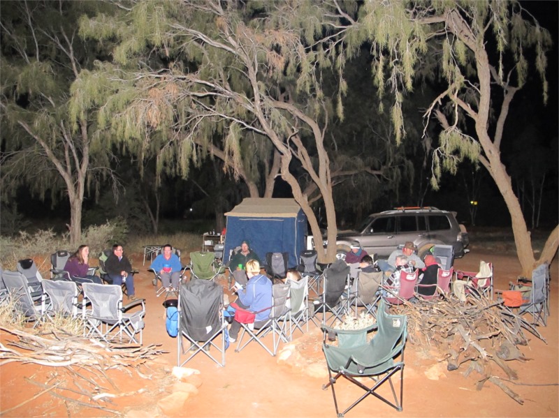
One of the dads put a sheet up between trees, fired up his laptop and put a movie on for the kids.
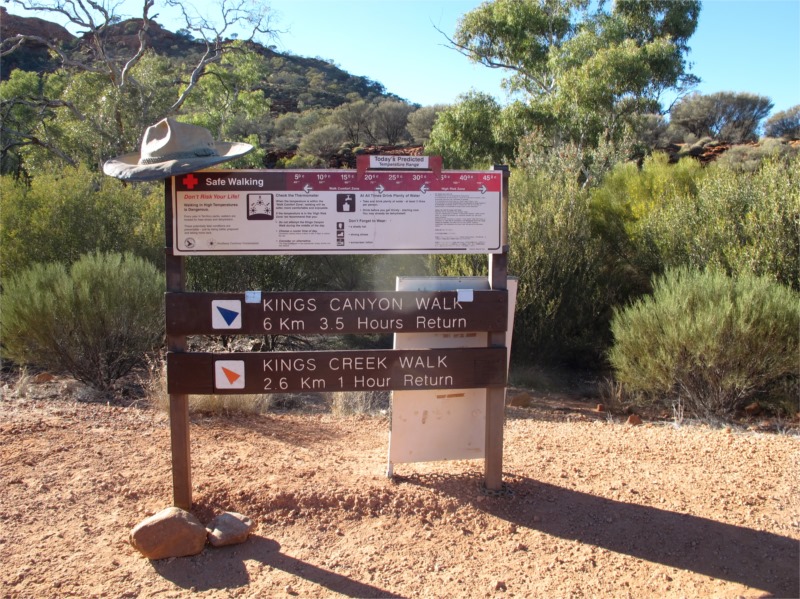
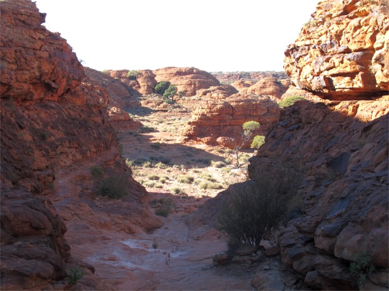
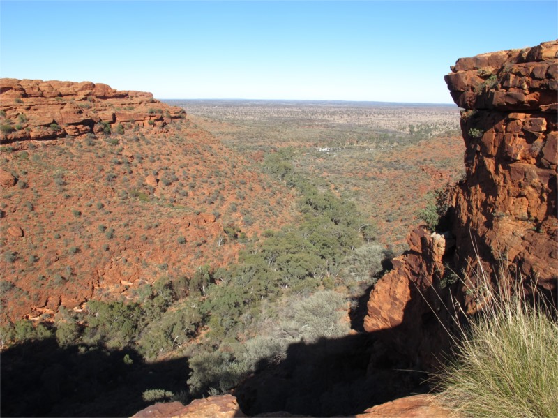
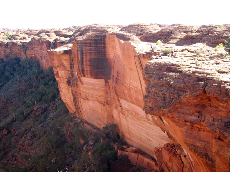
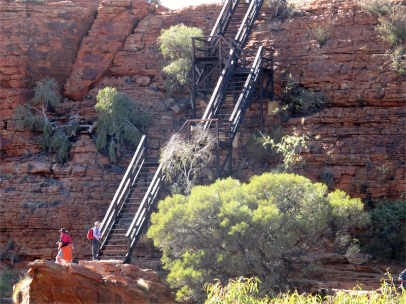
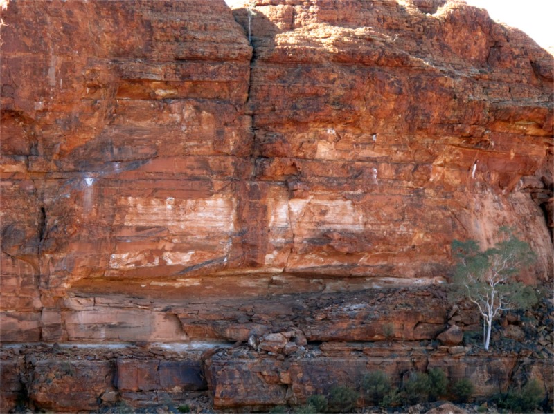
On the second day we woke to 1.9 degrees and we had ice on the bonnet of our car. The day did warm up to about 20 degrees and it was good temperatures for doing some walks. John and a few others decided to walk the Kings Canyon rim. It is 6km and takes about 3-4 hours, so we drove to Kings Canyon by about 9.30am. The Rim walk begins with a strenuous steep climb and is nicknamed “heart attack hill”. After that the walk ascends to the top of the Canyon and follows the rim around before descending into the carpark.
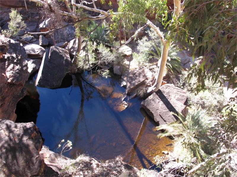
I decided not to do the walk and stayed at the bottom with one of the girls and read a book. There is a walk into the base of the canyon which I did and it was just beautiful. John and others loved the rim walk and took some wonderful photos. Maybe I can do it next time.
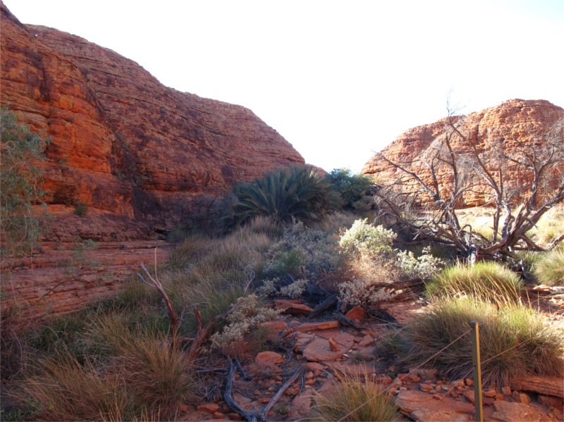
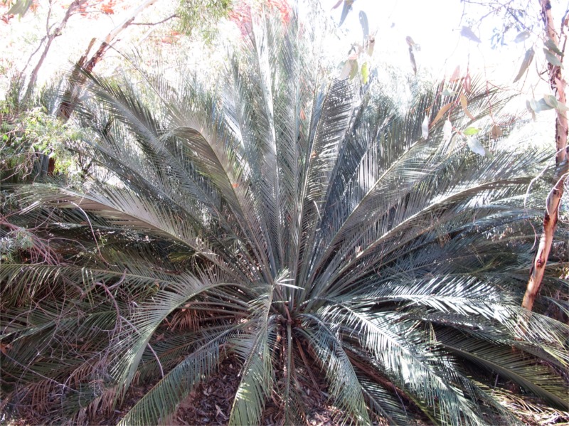
Some of the things to see is ripples in the rock which is evidence there were once shallow lakes in this area 400 million years ago. It just shows how much erosion has occurred over millions of years. The shear smooth rock is called Mereenie Sandstone. (Mereenie is the name of the road we will travel on tomorrow.) Kangaroos and wallabies are common here but their nocturnal habits and excellent camouflage make them hard to see. There are lots of bird life and they make nests in crevasses in the rock. There are 17 species of Cycad that have survived here since Dinosaurs roamed the earth and it was much wetter. (I love Cycads.)
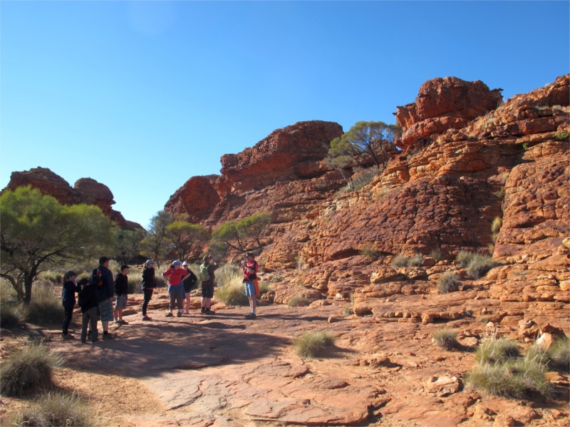
Various shots of the Kings Canyon Rim Walk
That night the 6 of us had or own fire as we were camped a little way from the others and it was too hard to find a spot by the big fire and keep warm. Val’s brother also joined us. He had come up from Melbourne and met us at Yulara and travelled with us to Kings Creek. He is in a sedan so won’t be coming on our inland trip but will meet up again with him in Alice. He and his two children had a great time and joined us in all the walks etc.
Monday 7 July 2014
Kings Creek Station – Palm Valley – 249kms
Monday we woke to 4 degrees which is warmer, packed up by 9.30 ready to move on. Val went on an early camel ride with her niece and nephew. We travelled into Kings Canyon and out onto the dirt road where we met up with everyone and travelled in a dusty convoy.
The trek to Palm Valley was via the Mereenie Loop (a permit is required which you buy at Kings Canyon service station) which wasn’t too bad just loads of dust and a bit of corrugation. We decided not to go into Gosse Bluff (the meteorite crater) as we’d been there before and it was a bit out of our way. If you ever do come out this way Gosse bluff is a must to see.
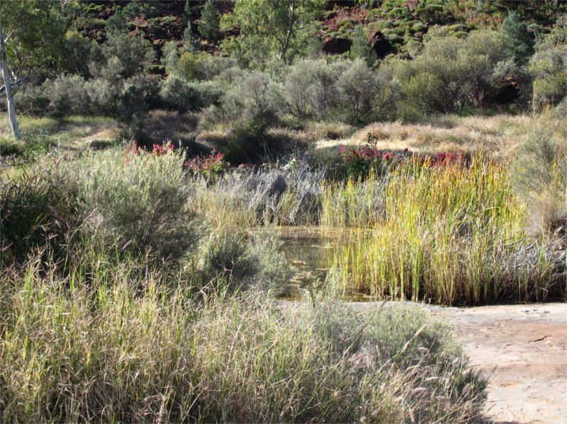
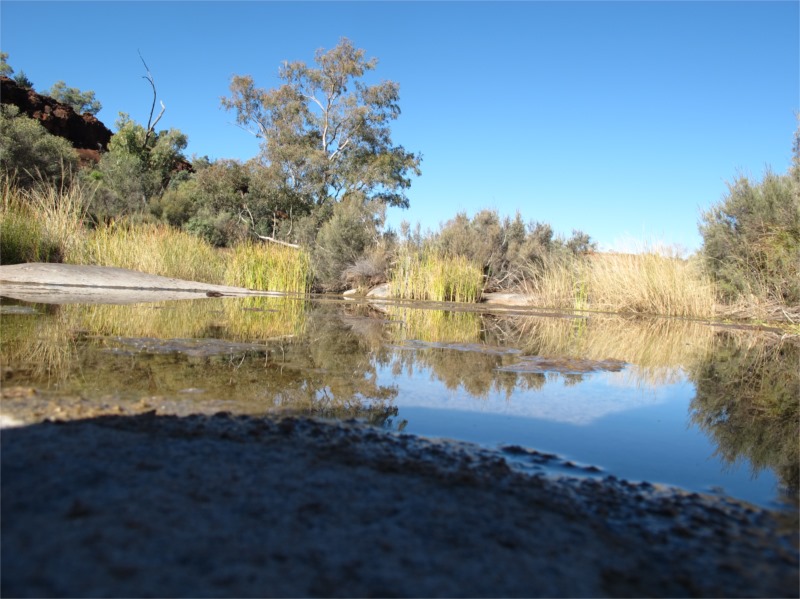
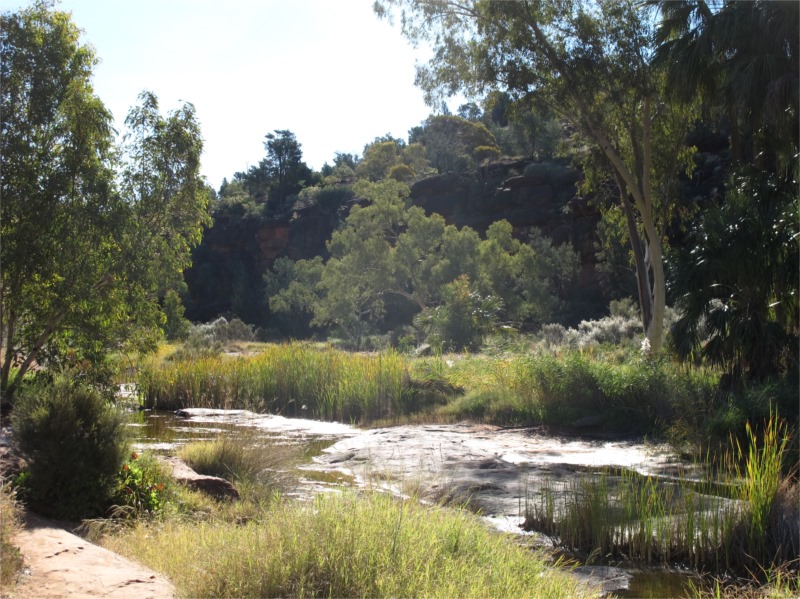
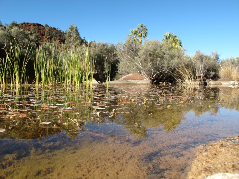
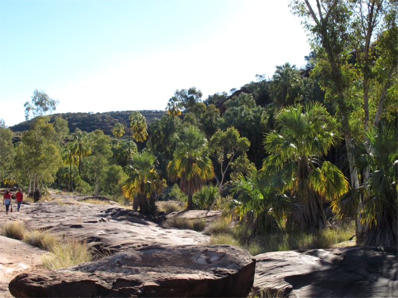
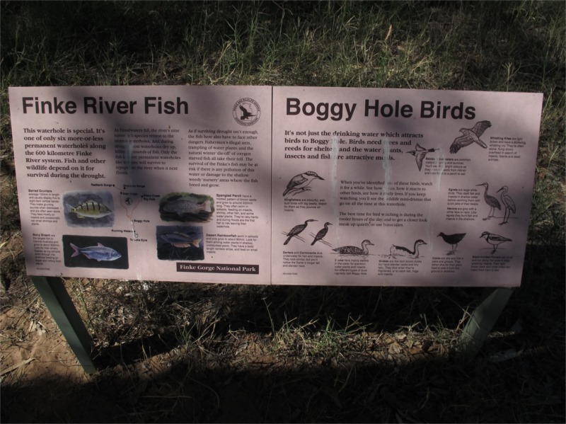
Palm Valley is located in the Finke Gorge National Park and is one of the most impressive places in central Australia. It covers an area of 46,000 hectares and is a maze of sandstone amphitheatres, pinnacles, gorges and is home to the Red Cabbage Palm after which the valley named. This particular species of palm is only found in this area.
The road into Palm Valley, up until now is the most corrugated road we’ve been on. At the end you had to make sure your teeth were still all intact and the thought of the return journey the next day was a bit daunting, but, to get anywhere beautiful in the outback you have to do the miles on bad roads. This trek was just that, absolutely beautiful scenery and worth every corrugation we travelled on.
On arrival we found a good bush camping spot, along with loads of other campers, and then travelled a little further into the valley to do some bush walks. On the way we noticed one of the convoy had a broken strut in the front of his car and they were working on it. It ended up that it couldn’t be fixed and the satellite phone one member had came in handy to ring NT equivalent of RACQ. They came out from Alice the next morning and took his car, camper and family back to Alice. This meant the family missed out on a couple of days tripping with us.
The bush walk as you will see by the photos was really picturesque and not to be missed. The palms are shown in photo 5 and the last photo was our view from our camp. This was taken at sunset.
We didn’t have a camp fire tonight as it was really too crowded and everyone had an early night after a full on day.
Various photos from trek through Palm Valley
Tuesday 8 July 2014
Palm Valley – Owen Springs – 269kms
We awoke to –1.9 degrees. Today was a 4WD trek we were looking forward to which is through the Finke Gorge. The Leader called a meeting around 9am to say he had talked to some campers nearby who had travelled the Gorge the day before and said lots of our camper trailers and in particular his caravan wouldn’t get through. We were a bit down cast about this but whilst the others decided not to go that way we (2 cars and us with a camper trailer) made the decision to take a risk and go. Everyone else could get to Owen Springs via another road (sealed, tempting).
We all travelled together out of Palm Valley and into Hermannsburg. Hermannsburg is an Aboriginal community and is known in the local Western Arrernte language as Ntaria. There is a population of 625, 86% being identified as Aboriginal. It was established as an Aboriginal mission in 1877 by two Lutheran missionaries from Germany and is named after a town in Germany. It is an interesting place with an art gallery, where many bought true Aboriginal art, trade store, service station of sorts. We only stopped for fuel and an ice cream (of course) and the three of us left everyone to travel down another dirt road to the gorge.
Apparently there was a funeral in Hermannsburg today and some of the group got caught in the procession travelling to the funeral. An interesting time for them.
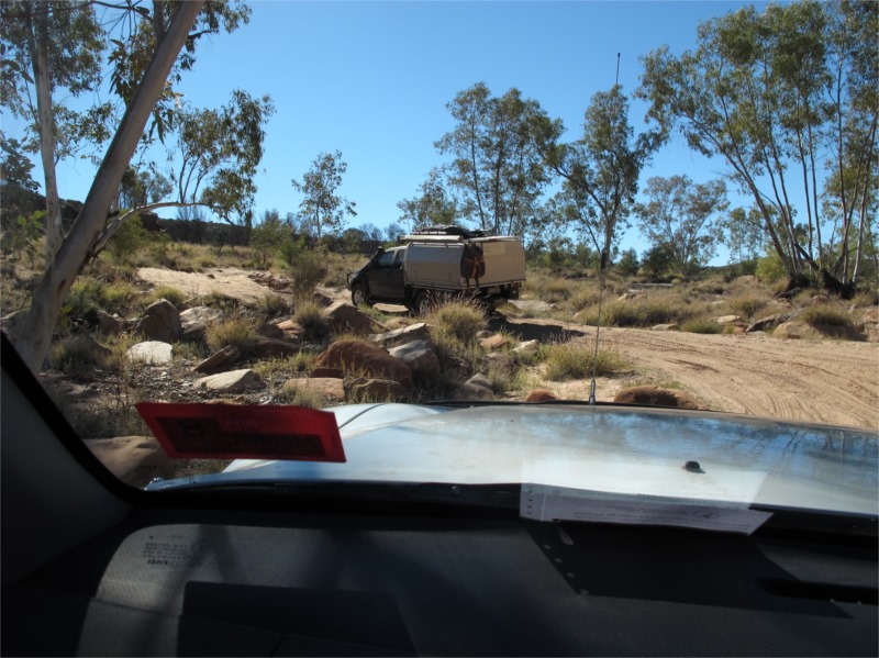
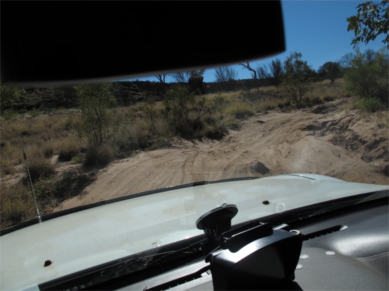
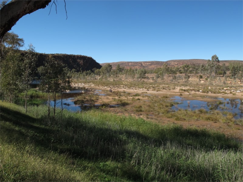
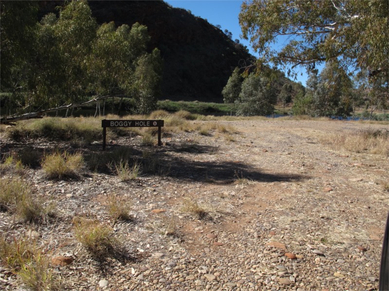
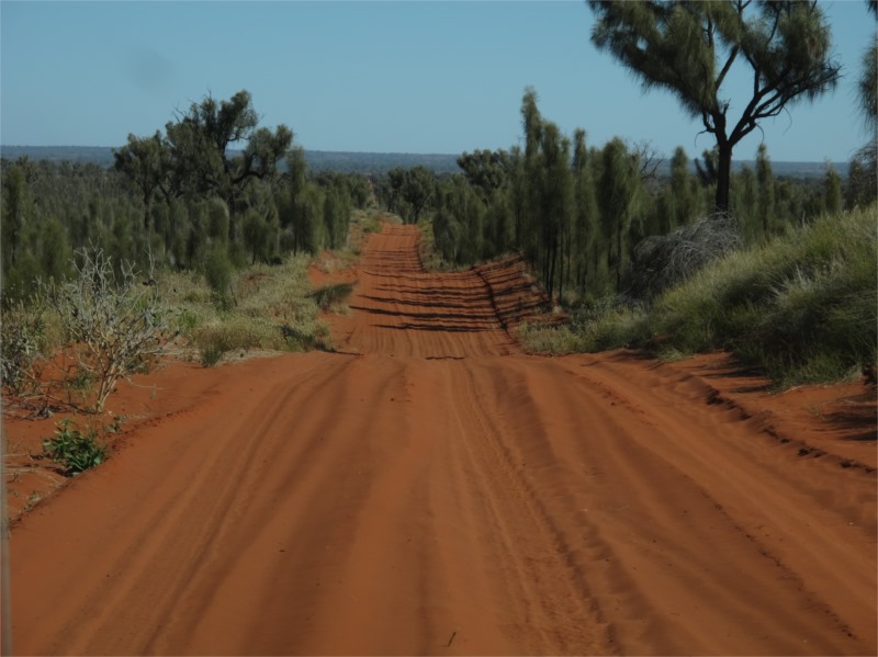
The route we travelled took in a spectacular section of the mighty Finke River and provided some challenging 4WDing. We travelled through deep sand, across dry river beds, through deep water, over boulders, clay pans and through very low trees, scrubs and narrow tracks in places. The track was hard to find at times but every so often there would be an arrow to point us in the right direction. We took it slowly and carefully and everyone got through okay. One place everyone talks about in the Gorge is Boggy Hole and you can free camp there. It was a really nice spot and we plan on going back there one day. The caravan certainly wouldn’t have got through and the camper trailers would’ve found it hard going and even though they would’ve got through 13 cars travelling together it would’ve taken all day.
Various shots of our trek through Finke Gorge
When we were just out of the gorge when our camper trailer got a flat tyre. Damn. Anyway that’s what spares are for and thank goodness we had replaced the spare before coming on the trip, as the old tyre was an original with the trailer which was about 10 years old.
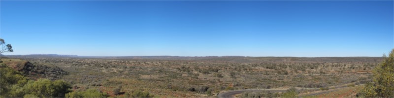
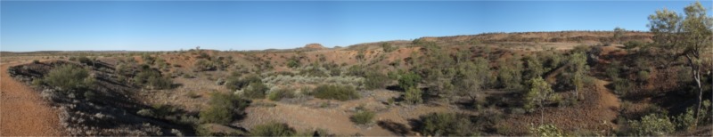
After replacing the tyre we travelled another 12.4 kms on the Ernest Giles Road and then into Henbury Meteorite Crater which is about 5km off the road. This reserve contains twelve craters which were formed when a meteor hit the earth’s surface 4,700 years ago. The Henbury Meteror, weighed several tonnes and accelerated to over 40,000km per hour, disintegrated before impact, and the fragments formed the twelve craters. Below is a panorama taken as we walked around. Well worth the stop.
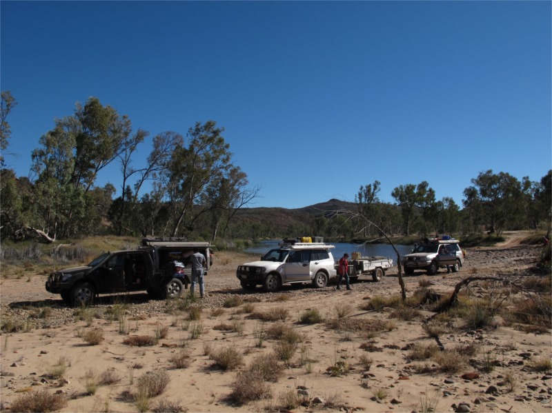
From there we travelled on to the sealed Stuart Highway then up to the Owen Springs Reserve, turning off the seal onto another rough road. We turned our 2-way onto the group channel and heard our Leader calling out to us, as he was expecting us to meet up around this time. Originally they were going to stop at Owen Springs but had decided to travel to Redbank Creek and set up camp. We were happy about that as they were only about 4kms from us where Owen Springs was 70kms. After a long day this was welcomed. We found them camped on the river bed, a bed of smooth stones, and set up camp. Tonight there was enough room for everyone to sit around the camp fire and even room to have a fire for the kids nearby.
We told many tales, and I say tales as we made up a few about our solo trip through the Gorge, but then our guilt caught up with us and we told the truth, just having fun with everyone. We, the Queenslanders, were travelling from here to Alice tomorrow to get ready for our desert crossing, so tonight was the last night with our new MySwag friends so there was a lot of farewells and exchanging email addresses etc. We had bought a gift for our Leader which we presented him and his wife privately. The rest of the group still had a few days in the outback before travelling every which way back to their homes.
Wednesday 9 July 2014
Redbank Creek – Alice Springs – 100kms
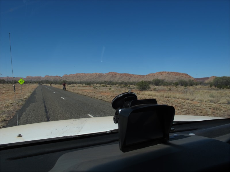
Awoke to 3 degrees and yet another day of blue skies. We were in no rush so slept in and waved goodbye to everyone before leaving ourselves. We decided to go up to Owen Springs as there is a lot of history in the area.
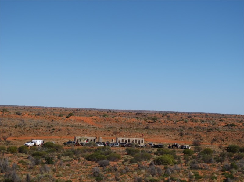
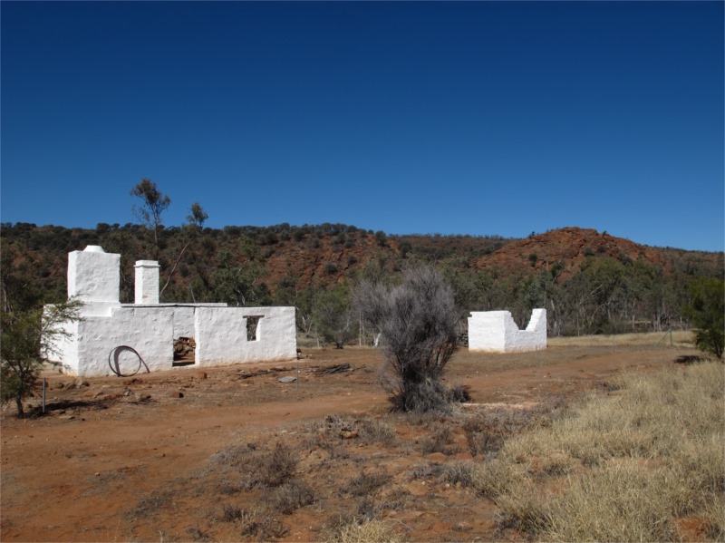
Owen Springs Reserve, is formerly a cattle station and was acquired by the NT government in 2000 and opened in 2003 as a reserve. The main access track we travelled closely followed the original route John McDouall Stuart took through the MacDonnell Ranges between 1860 and 1862. This trek opened up Central Australia to white settlement. During the explorations the waterhole was named Owen Springs and the construction of the Overland Telegraph Line was established following the Hugh River through this gorge. A cattle station was established and a homestead built which was the first homestead in Central Australia. We saw the remnants of this building (see photos below). It was a very pretty drive and a bit sad when we finally hit bitumen again. Ha Ha!
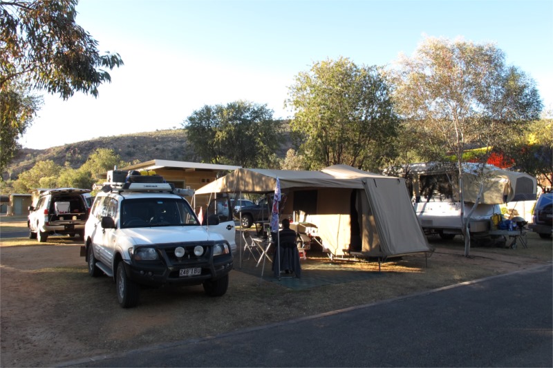
We put air into our tyres and travelled to Alice, each family doing their own thing getting supplies, fuel, I needed a doctor etc. We were looking forward to our Ensuite and a loooooong hooooooot shower again and as clothes were short washing was a must.
We all stayed at the same caravan park (MacDonnell Range Holiday Park) and all met at the “shed” that night to watch the State of Origin. We had our Maroon tops on, hats and scarves and were full of confidence that we would win. There was a great atmosphere and most people were from Qld. We won of course but it was freezing so after the game we all retired early.
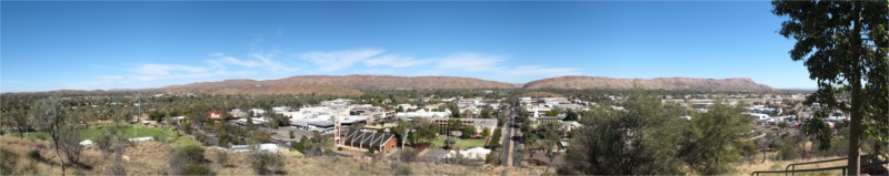
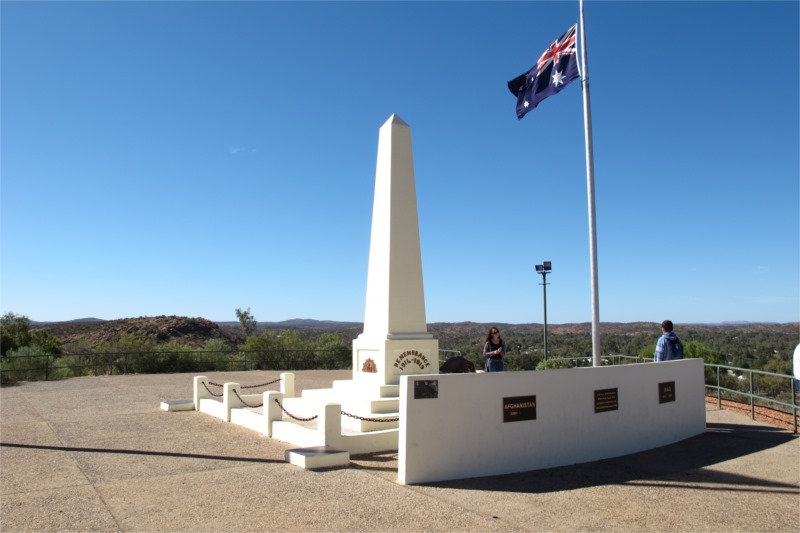
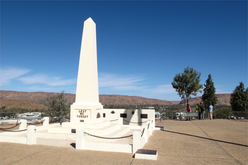
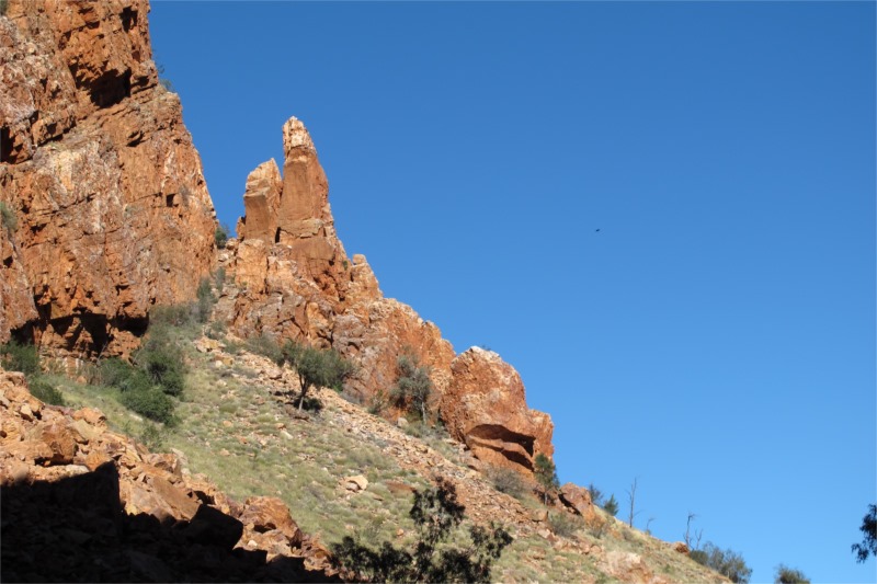
Here are some photos of Alice Springs.
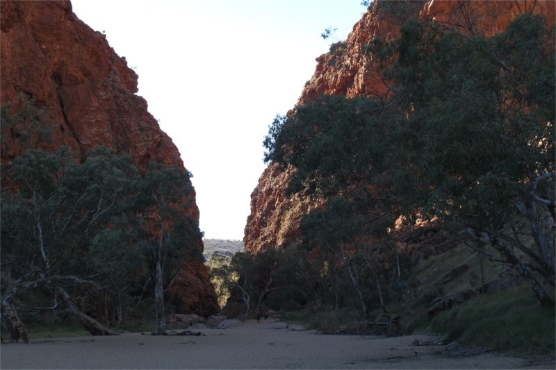
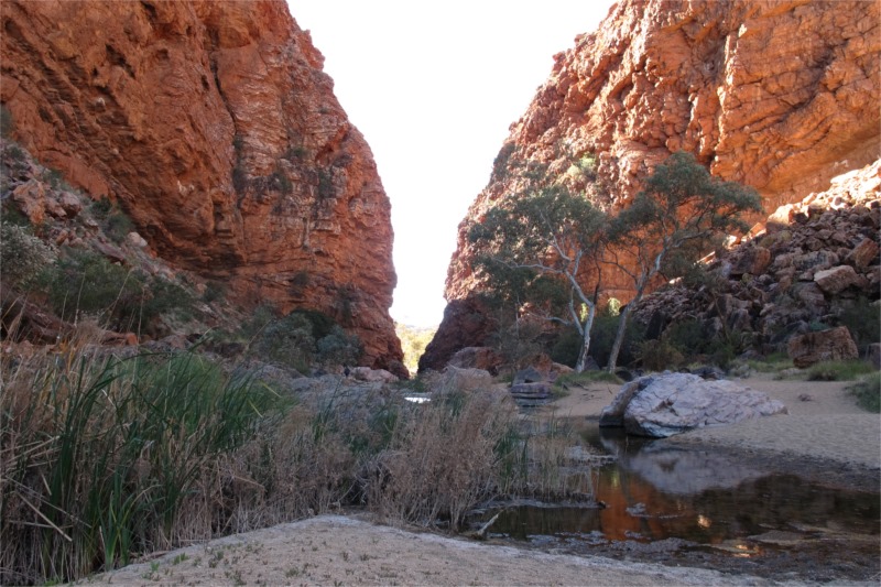
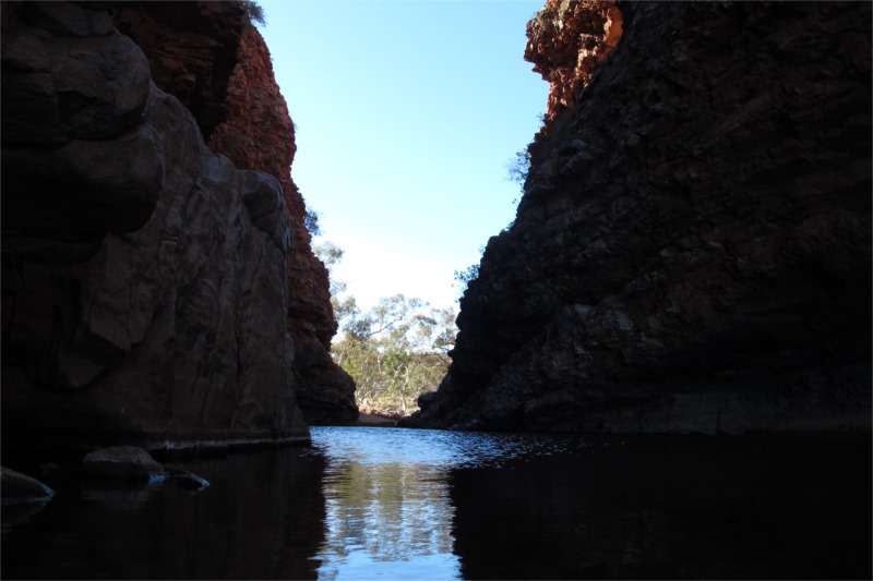
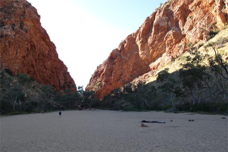
Photos of entering Simpsons Gap and inside the Gap.